COMPUTATIONAL AND DIGITAL METHODS
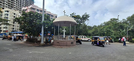
SITE: Gorai Jetty, Borivali West

AA'
BB'
CC'
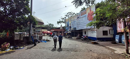
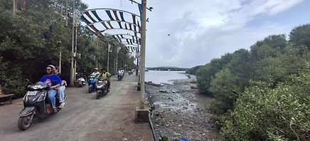
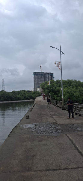
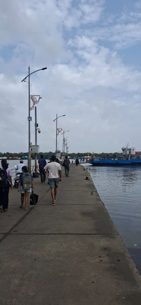
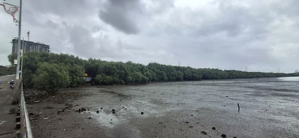
The Gorai Jetty is situated at the border of the Borivali suburb of Mumbai, serving as a ferry point for transit between Mumbai and Gorai Village, Manori Village, and other smaller island settlements across the Gorai creek. The jetty is surrounded by dense mangroves, marshland, tidal waters, and activities like fishing.
Commuters using the ferry service mainly include tourists and workers. Tourists use the ferry in order to commute to theme parks like Water Kindgom and Essel World, and also to religious locations like the Global Vipassana Pagoda. Workers commute from the smaller islands across the creek to the urban mainland for their jobs with small vehicles like bikes and scooters.
The use of vehicles like bikes and scooters on the jetty is hence seen as a result. Since the jetty's width tends to shrink as one goes down the slope, the crowd of people as well as the bikes and scooters also tend to start concentrating at one point, creating a bottleneck.


Section- AA'

Section- BB'

Section- CC'
While I was on my visit to the site, and trying to experience everything around, I noticed that people often become alert while navigating through the congestion point mentioned above, and tend to move to the side to give space for vehicles. In the meantime, they also gaze around, towards or at various subjects like the surrounding mangroves, or the overall landscape across the creek.


Hence, based on my observations, I was interested in mapping out the human behavior of pausing or slowing down at a certain spot due to the consequence of some subject catching their eye, or perhaps influenced by a more intense purpose.
Observation Diagrams

.jpg)


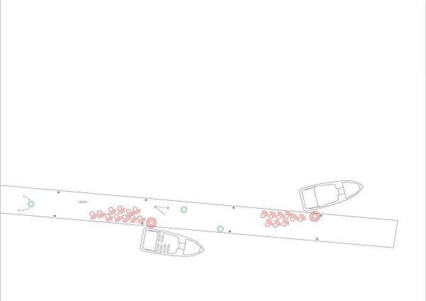
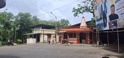
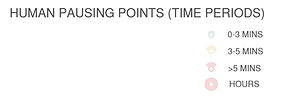
People under the category of '0-3 minutes' technically comprise of every type of person, but specifically of pedestrians, temple visitors and vehicle owners (due to the presence of a car parking lot nearby).
People under the category of '3-5 minutes' comprise of people buying from vendors, waiting at the ferry ticker counter, and those waiting or taking shade under the small shelter of the fish market opposite the police station.
People under the category of 'more than 5 minutes' comprise of passengers waiting at the bus stop, and at the end of the jetty point for the ferry, people using the public toilet, vendors, shopkeepers, and auto-rickshaw drivers at the rickshaw stand outside the gate, at the circle, looking for passengers.
People under the category of 'hours' again mainly comprise of vendors, shopkeepers. and auto-rickshaw drivers.
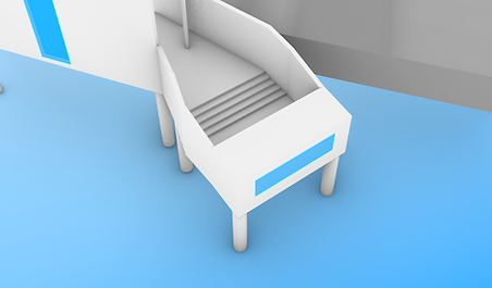
Site Intervention

Finally, after mapping out the spots, I came to a conclusion and chose the above spot for intervening my structure, where, as per my earlier analysis, this spot was the center point for the density. By intervening my structure here, I could also find a way of diverting the congestion at this spot caused by vehicles passing through, and at the same time, make spaces for people in order to indulge with the surrounding environment, influenced by their own behavior and by my own experience.
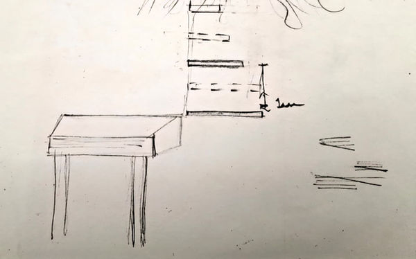
Logic Diagram

I selected two point sources on either side of the ramp, one at the bottom and one at the top. From these points, I extended rays in different directions determined by human vision to achieve a form, and hence got the idea of creating several framed spaces, each frame carrying their own language according to what it frames in that direction.

Horizon
Horizon
Mangrove (Trunk and Foliage)
Mangrove (Roots)
Since the site is highly influenced by water tide levels, I also decided to play around with different heights, and started creating iterations.
Iterations


Final Model

Isometric View

Plan

Elevation


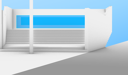
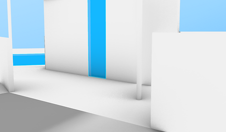


More Views